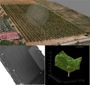
 The objective of this bundle is to monitor the crop development during crop season to detect possible biotic or abiotic stress sources and their effect.
Technologies:
[Photogrammetry]
[Drone]
[Satellite]
[Computer vision]
The objective of this bundle is to monitor the crop development during crop season to detect possible biotic or abiotic stress sources and their effect.
Technologies:
[Photogrammetry]
[Drone]
[Satellite]
[Computer vision]
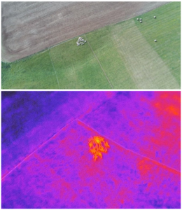
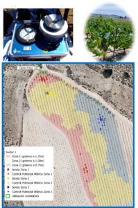 This bundle seeks to assess water stress in vineyard based on multispectral and thermal imagery obtained with drones. It requires field measurements in specific vines of the plot.
Technologies:
[Photogrammetry]
[Drone]
[Computer vision]
This bundle seeks to assess water stress in vineyard based on multispectral and thermal imagery obtained with drones. It requires field measurements in specific vines of the plot.
Technologies:
[Photogrammetry]
[Drone]
[Computer vision]
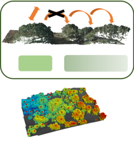
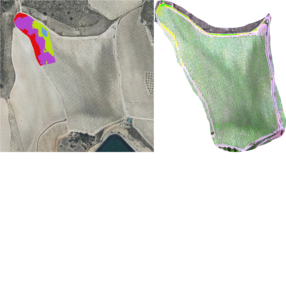 This bundle aims to determine difference zones in a plot that would require different inputs (fertilizers and canopy treatment, among others) based on the soil differences. It uses the concept of “crop as a sensor”.
Technologies:
[Photogrammetry]
[Drone]
[Computer vision]
 With this bundle, the flora available in high-altitude areas for herd feeding will be monitored and its quality evaluated using integrated drone and satellite information.
Technologies:
[Photogrammetry]
[Drone]
[Satellite]
[Computer vision]
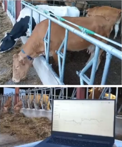 In this bundle, we collect parameters from livestock to monitor their health and stress levels in real-time.
Technologies:
[Collar Prototype]
[IoT]
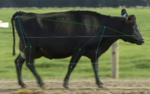
In this bundle, we employ Pose estimation algorithms in conjunction with video frames to achieve lameness detection in cows.
Technologies:
[Image recognition]
[Pose estimation]
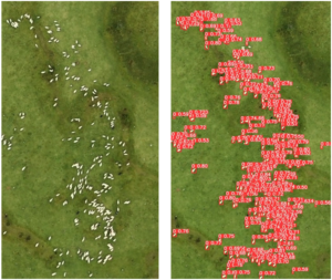
In this bundle, we analyze video frames to achieve detection and localization of sheeps and goats.
Technologies:
[Image recognition]
[Drone]
In this bundle, we utilize RGB images and thermal camera images to monitor the health of animals in herds.
Technologies:
[Computer vision]
[Image recognition]
[Drone]
 In this bundle, we conduct a tree census (number and type) for inventory purposes.
Technologies:
[LiDAR]
[Drone]
[Satellite]
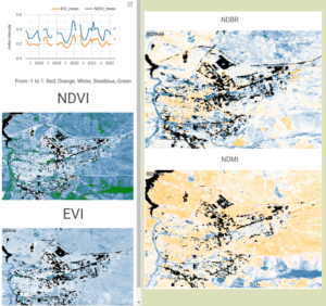
 The aim of this bundle is to analyze and monitor vegetation continuity to prevent fire spread.
Technologies:
[Photogrammetry]
[Drone]
[Satellite]
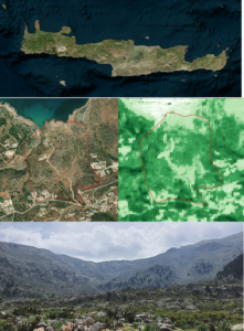
This bundle seeks to identify potential risks at the Wildland-Urban Interface, a priority area for fire prevention, and to establish action plans.
Technologies:
[Photogrammetry]
[Drone]
[Satellite]
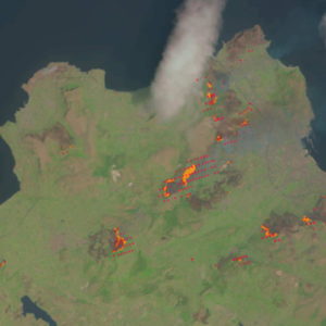 This bundle aims to enhance the current hotspot detection and alert system, especially focusing on overseeing recently extinguished areas to prevent new fires.
Technologies:
[Drone]
[Satellite]
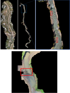 The goal of this bundle is to prevent accumulations of large woody debris, which could block rivers resulting in floods after extreme rain events.
Technologies:
[Image recognition]
[Drone]
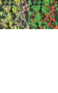 Using this bundle, automated detection of pest outbreaks in forested areas (mainly bark beetles) will be performed and based on RGB and multispectral UAV imagery.
Technologies:
[Photogrammetry]
[Drone]
[UAV]
[Computer vision]